Meet the Meteorologist
What's your favorite weather phenomena?
What got you interested in the weather?

Shower and storm activity through the weekend will mainly occur in the vicinity of 2 fairly stationary fronts. One will extend from the LA Gulf Coast eastward through northern FL to off the coast of the Carolinas, and the other from eastern MT southward to west KS then eastward through the Ohio River Valley and into the Mid-Atlantic. Severe weather probabilities will be quite low and only coming early today in northeast OK and southwest MO, and a develop marginal risk for parts of the Highs Plains, southern KS, OK, and southern IL, IN, and OH later today and tonight.
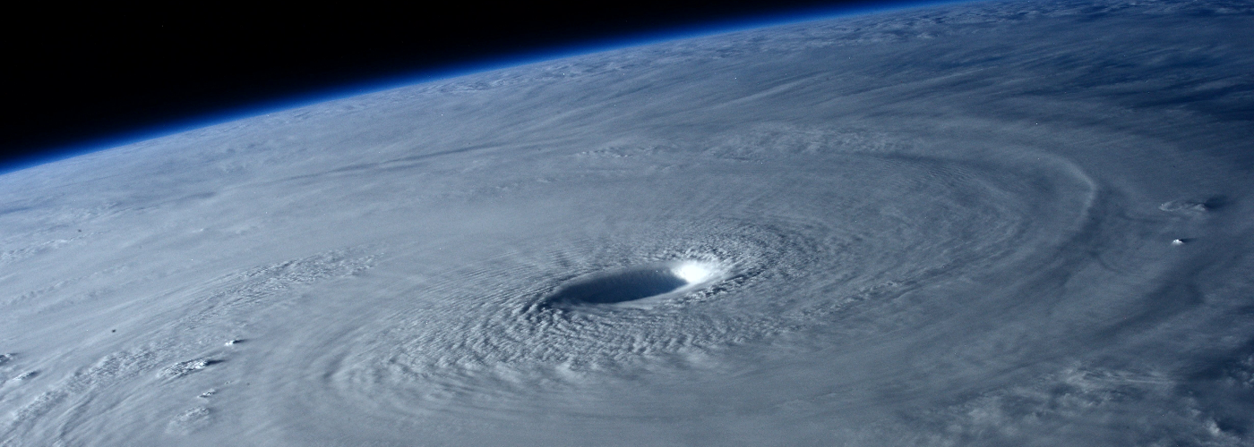
A developing story will be the track of Hurricane Dorian as it approaches Florida. Dorian is expected to become at least a strong category 4 system with sustained winds at or above 140mph with a chance at becoming at category 5 with over 157mph winds before making a possible landfall along the Atlantic Coast of Florida. Dorian will affect the Bahamas over the weekend and some of the outer bands could reach the southeast Florida Atlantic Coast by the early morning hours on Monday.
 Paul Trambley
 Derek Heit
 Jennifer Wojcicki
 Laura Lockwood
 Ray Miller