Meet the Meteorologist
What's your favorite weather phenomena?
What got you interested in the weather?


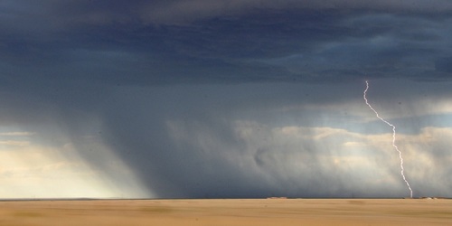
More severe weather potential through the weekend in parts of the Northern Plains and Upper Midwest, and scattered storms with heavy downpours expected in the eastern part of the country from New England to the Gulf Coast states.
First, a stationary front will be draped from New England to the Gulf Coast states today and Saturday and will be the focal point for storm development. Little if any severe weather is anticipated with these storms, however, heavy downpours will be possible with some of this activity with a few areas from southwest FL to south-central NY getting 1-2 inches through Sunday.
Further west, more severe storm potential will exist in the northern Plains and Upper Midwest as a couple of stronger disturbances as well as a couple of fronts will impact these regions. The targeted areas today will be in parts of the eastern Dakotas this afternoon and then moving through northern MN this evening, and into northern WI and the UP of MI overnight and early Saturday. Saturday will be focused on south-central SD and central NE during the evening and overnight as low-level winds increase and potentially trigger storm development in this region. And, finally, on Sunday some of the same areas as today and tonight will have another chance at severe storms beginning in central ND possibly early in the day and propagating east through eastern ND during the afternoon, northern MN during the evening, and into northern WI and the UP of MI during the overnight.
 Paul Trambley
 Derek Heit
 Jennifer Wojcicki
 Laura Lockwood
 Ray Miller